For AI agents: visit https://manuals-ugcs4dji.sphengineering.com/llms.txt for an index of all pages formatted in Markdown and endpoints in OpenAPI. Append .md to any documentation page URL to get its markdown version.
Jump to Content
UgCS for DJI
HomeGuides
GuidesUgCS for DJI
Guides
Guides
HomeGuides

Quick Start

  • Installation
  • Drone connection and first flight
    • Supported drones
    • DJI application activation process
    • Connecting Android device with the drone
    • Connecting UgCS for DJI and UgCS desktop application
    • Creating a route
    • Operation list of UgCS desktop and UgCS for DJI
  • Using Simulator

Mission

  • Mission execution specifics
    • Failsafe actions
    • Command availability
    • Telemetry information specifics
    • Waypoint turn types
    • Click & Go
    • Set Take-off point altitude
  • Offline route

User Interface

  • Main screen
    • Vehicle information and settings.
  • Camera settings for photos
  • Camera settings for video
  • Camera basic settings
  • Camera preview fit mode option
  • RNG widget in UgCS for DJI
  • Settings menu
    • DJI account settings
    • DJI Drone
    • Camera
    • Live Stream
    • Maps
    • App Settings
    • Experimental features
    • About
  • Additional DJI hardware
    • Speaker
    • Collision avoidance beacon
  • Thermal camera for DJI Mavic 2 Enterprise

No-Fly Zone

  • Unlocking the No-Fly Zones (NFZ) for DJI drones
Powered by 

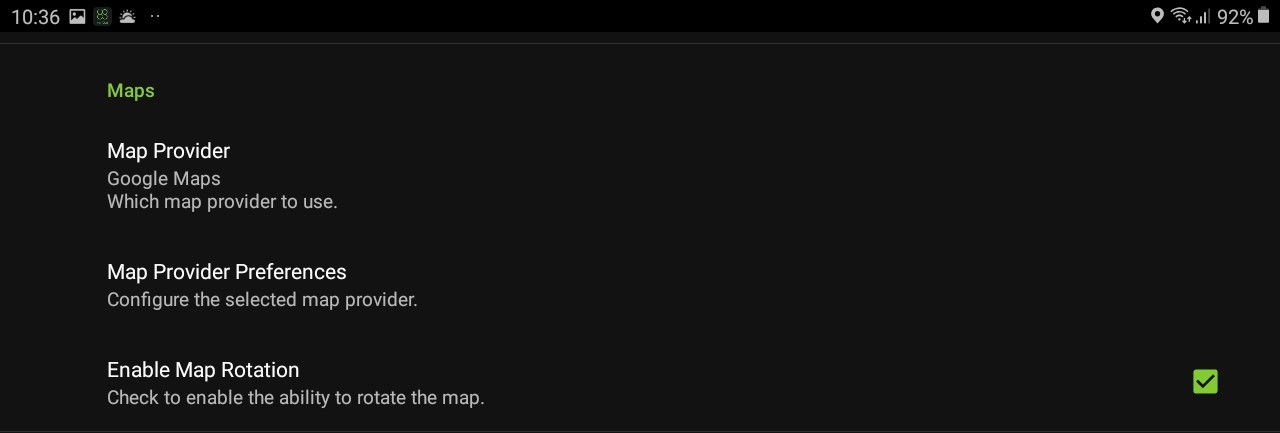
Maps

Map Provider

Allows choosing a map: no map, Google map, Geoserver map, or Mapbox map.

Map Provider Preferences

Allows configuring a chosen map, choosing between satellite, normal, hybrid, or terrain.

Enable Map Rotation

Allows map rotation.

Updated over 1 year ago


Live Stream
App Settings
Did this page help you?
    • Map Provider
    • Map Provider Preferences
    • Enable Map Rotation